 |
Washington DC (SPX) Jul 26, 2010 Antarctica may not be the world's largest landmass - it's the fifth-largest continent - but resting on top of that land is the world's largest ice sheet. That ice holds more than 60 percent of Earth's fresh water and carries the potential to significantly raise sea level. The continent is losing ice to the sea, and scientists want to know how much. Antarctica's ice generally flows from the middle of the continent toward the edge, dipping toward the sea before lifting back up and floating. The point where ice separates from land is called the "grounding line." For scientists, an accurate map of the grounding line is a first step toward a complete calculation of how much ice the continent is losing. Such a map is a primary objective of the Antarctic Surface Accumulation and Ice Discharge (ASAID) project. Researchers from NASA's Goddard Space Flight Center in Greenbelt, Md., led a team that used high-resolution satellite images, along with newly developed computer software, to trace the most accurate Antarctic grounding line ever compiled. "This project has been a major achievement to come from the International Polar Year," said Robert Bindschadler, a cryosphere scientist based at Goddard who presented his team's work in June at the International Polar Year Oslo Science Conference. "This project included young scientists, it was an international effort, and it produced freely available data - all from satellites." Much public attention has been focused on the Arctic, where ice loss is accelerating. Antarctica, however, is also steadily losing ice. NASA satellites have shown ice losses around the entire continent, with pronounced changes in the northern region around the Antarctic Peninsula. The most significant changes are likely to occur at the intersection of the ocean and the ice sheets. At what rate is Antarctica's ice is lost to the ocean? It's a tricky question because of Antarctica's immense scale. Previously, researchers calculated the speed of outflow from 33 of Antarctica's biggest outlet glaciers, but that accounts for just half of what is lost, as outlet glaciers makes up only 5 percent of the coastline. The rest of the coastline might lose ice through icebergs that calve off from outlet glaciers or over land cliffs. Sometimes ice flows gently from glaciers that extend far into the ocean as floating ice shelves or skinnier ice tongues. In other cases, the ice never reaches the ocean at all. To draw the new grounding line, the team of NASA and international scientists worked with a mosaic of high-resolution images of the continent from the Landsat 7 satellite. Using software developed by Goddard's Hyeungu Choi, the team collated and mapped points from previously mapped lines, high-resolution imagery, and some new information about surface elevation. "Completion of this line was huge, as we connected 3.5 million geographic points around the continent," said Goddard's Amy Wichlacz, who popped a cork in celebration after eight months of meticulously connecting the dots. The team found that the grounding line around the edge of the ice sheet follows a winding path 53,610 kilometers (~33,312 miles) long. The high-resolution imagery makes the new map more precise than previous assessments of grounding lines, which sometimes mistakenly included shadows and islands as part of the continental landmass. The next step is to use satellite elevation data from ICESat to determine the ice thickness near the grounding line. The new map and elevation data, along with thickness information (once complete), will be turned over to the National Snow and Ice Data Center in Boulder, Colo. Knowing where ice leaves the land, combined with the thickness of ice in the vicinity and speed of the ice, allows scientists to calculate how much ice is being lost.
Share This Article With Planet Earth
Related Links Landsat Image Mosaic of Antarctica Earth Observation News - Suppiliers, Technology and Application
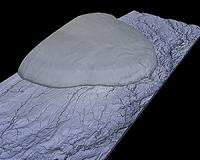 TanDEM-X Delivers First 3D Images
Bonn, Germany (SPX) Jul 23, 2010 On 22 July 2010, researchers at the German Aerospace Center facility in Oberpfaffenhofen published the first 3D images from the TanDEM-X satellite mission. Just one month after the launch of TanDEM-X, which took place on 21 June 2010, DLR researchers have created the first digital elevation model - almost a week ahead of schedule. A group of Russian islands in the Arctic Ocean was selected ... read more |
|
| The content herein, unless otherwise known to be public domain, are Copyright 1995-2010 - SpaceDaily. AFP and UPI Wire Stories are copyright Agence France-Presse and United Press International. ESA Portal Reports are copyright European Space Agency. All NASA sourced material is public domain. Additional copyrights may apply in whole or part to other bona fide parties. Advertising does not imply endorsement,agreement or approval of any opinions, statements or information provided by SpaceDaily on any Web page published or hosted by SpaceDaily. Privacy Statement |


 del.icio.us
 Digg
Digg Reddit
 YahooMyWeb
 Google