 |
Pasadena CA (JPL) Feb 28, 2011 A day after a powerful magnitude 6.3 earthquake rocked Christchurch, a city of 377,000 on New Zealand's South Island, on Feb. 22, 2011, the Advanced Spaceborne Thermal Emission and Reflection Radiometer (ASTER) instrument on NASA's Terra spacecraft imaged the Christchurch region. The imaging was done at the request of the International Charter, Space and Major Disasters, which provides emergency satellite data to federal agencies in disaster-stricken regions. Two images are presented here. The first is a perspective view showing the city of Christchurch and the Banks Peninsula at upper right, location of the quake's epicenter in Lyttelton. The Banks Peninsula is composed of two overlapping extinct volcanoes. The perspective view was created by draping the ASTER natural color image over the 3-D ASTER topographic data. The second image is a nadir view pointing straight down to the ground. The images cover an area of 19 by 26 kilometers (12 by 16 miles), and are located near 43.5 degrees south latitude, 172.6 degrees east longitude. The resolution of ASTER is not sufficient to spot damage to individual buildings. The quake-the worst natural disaster to hit New Zealand in 80 years-struck at 12:51 p.m. local time on Feb. 22. It was centered in Lyttelton, just 10 kilometers (6.2 miles) southeast of Christchurch, at a shallow depth of just 5 kilometers (3.1 miles). It is considered to be part of the aftershock sequence of the much larger magnitude 7.0 earthquake of Sept. 4, 2010, which was centered 45 kilometers (30 miles) west of Christchurch. That quake, while larger, resulted in injuries and damage but no fatalities. According to the U.S. Geological Survey, the Feb. 22 quake involved faulting at the eastern edge of the aftershock zone from the Sept. 2010 event. The earthquake is broadly associated with deformation occurring at the boundary of the Pacific and Australia tectonic plates. Previously released NASA topographic views of New Zealand and the Christchurch region from ASTER and the Shuttle Radar Topography Mission (SRTM) can be viewed here and here. A flyover animation of New Zealand created from SRTM data can be viewed here.
Share This Article With Planet Earth
Related Links ASTER Earth Observation News - Suppiliers, Technology and Application
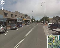 Ministerial Panel Deliberates Google's Planned Launch Of Street View
Jerusalem (XNA) Feb 28, 2011 A Israeli ministerial team headed by Intelligence and Atomic Energy Minister Dan Meridor on Monday discussed Google Street View, which is due to be operated in Israel in the near future. Experts were invited to present various implications regarding issues of privacy and public security, as well as the potential advantages of the search engine giant's application for tourism and image, acc ... read more |
|
| The content herein, unless otherwise known to be public domain, are Copyright 1995-2010 - SpaceDaily. AFP and UPI Wire Stories are copyright Agence France-Presse and United Press International. ESA Portal Reports are copyright European Space Agency. All NASA sourced material is public domain. Additional copyrights may apply in whole or part to other bona fide parties. Advertising does not imply endorsement,agreement or approval of any opinions, statements or information provided by SpaceDaily on any Web page published or hosted by SpaceDaily. Privacy Statement |


 del.icio.us
 Digg
Digg Reddit
 YahooMyWeb
 Google